
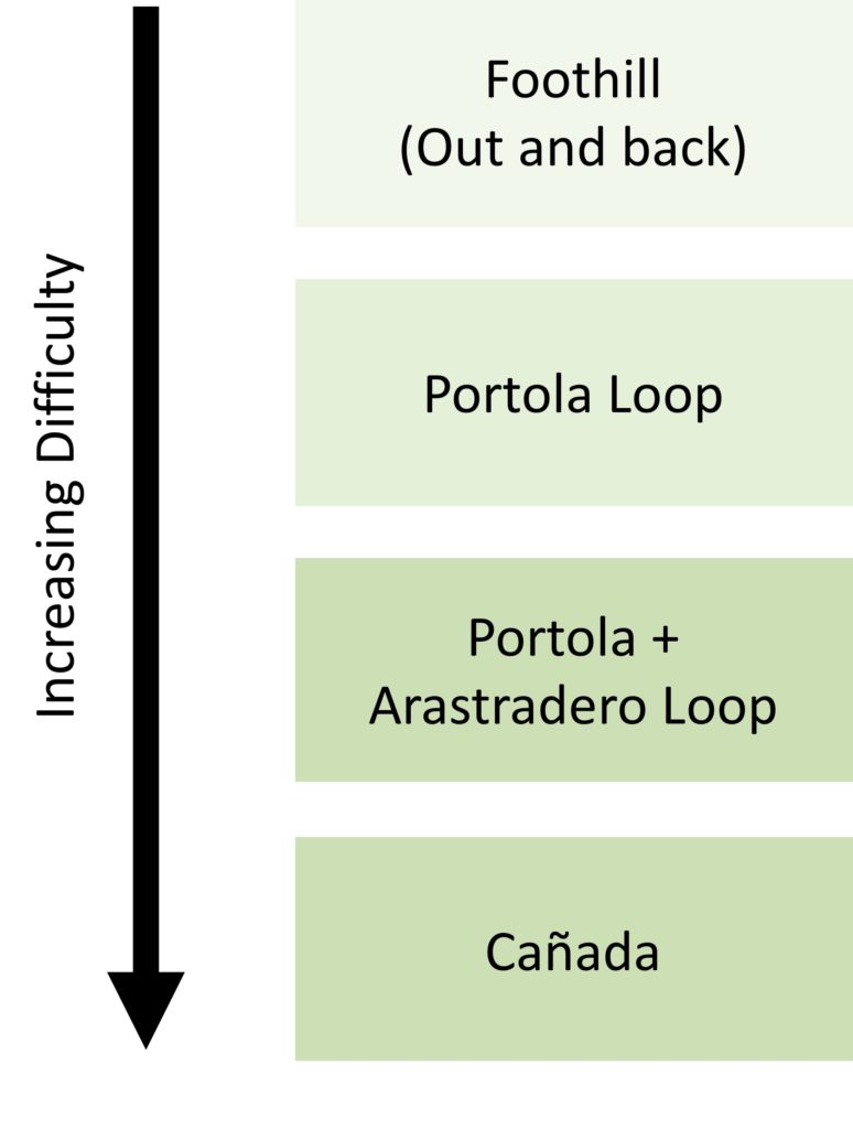
We are working to revamp our local routes to include more rides and to update from black and white aerial photographs to Strava route and activity links. The old local routes page is available temporarily here.
Road
Flattish and Rolling
Google Maps
Good beginner route, take bike path to avoid foothill on the way back, and check out for donkeys. Feel free to dash up any exciting looking side roads, just know that some can kick up (and give nice views of the bay!)
Google Maps
Good beginner loop with uphill through Arrastradero and downhill Alpine back to Stanford.
Ideal option for a flat route with no stop lights on a recovery day. The standard route normally starts off by heading up Alpine to Portola and taking Portola to Sand Hill. The reverse direction is popular with the tailwind speedsters dashing along the downward slant of Alpine Rd. The benchmark 15 mile route can be enhanced by further additions like Arastradero; going to the gate at the end of Alpine; adding the “maze” to it in Woodside. The “maze” is short for: taking Tripp on 84E to Kings, R on Kings, L on Manuella, L on Albion and R on Olive Hill to Canada (or the reverse direction). Time: 45 mins to 1 hr +.

A rolling road from Woodside to 92 with nice reservoir/skyline ridge views that is populated with both time-trailing (TT) riders and families out having fun on bikes-only Sundays. Can be embellished by adding the Crystal Springs loop to it (extra 7 miles). Runnymede Rd which runs parallel to Canada starting with 280 underpass (before Jefferson) is used for echelon TTT practice because it has virtually no traffic.
Foothill is flat but peppered with stoplights- but head far enough south and you escape the traffic and get to beautiful Steven’s Creek, with enjoyable options to meander through Rancho San Antonio. For those who hate stop lights or want variety, the route that is parallel to Foothill is normally taken by turning right at Homestead/Vineyard. The linked map has both the direct route and a side-stepping (but steeper) meander through Los Altos hills.
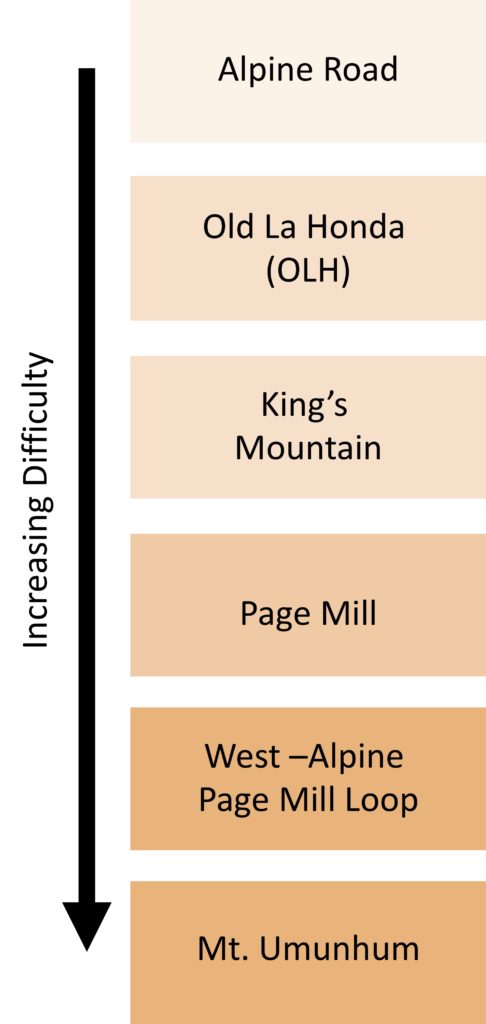
Longer Climbs
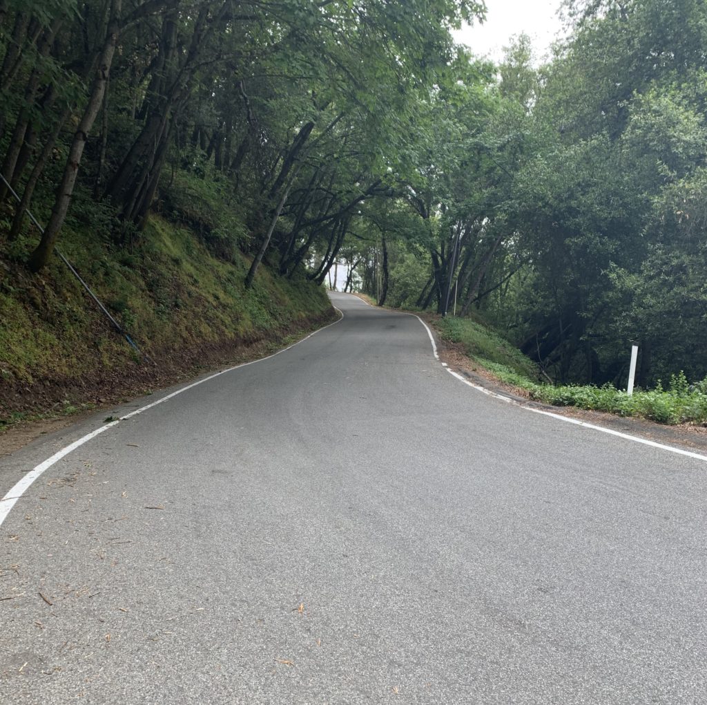
From Sand Hill Road to Portola Valley Road, Alpine Road has a significant amount of automobile traffic but is still quite ridable. In these 4.2 miles it gains approximately 400 feet. South of Portola Valley Rd, however, the road narrows, and enters the beautiful Corte Madera Open Space Preserve. Aer a relatively flat initial 1.3 miles, the grade steadily increases for another 1.6 miles. Here, just past the intersection with Joaquin Road, Alpine is gated and the pavement ends. It remains dirt for 2.5 miles, gaining approximately 950 feet, until joining the top of Page Mill Road. The dirt portion is popular with beginning mountain bikers but is also fun and quite doable on a road bike, climbing or descending, if it hasn’t rained during the previous few days. Unfortunately, a landslide has taken out a significant section of Alpine Road, leaving it impassable by bike. A single-track detour bypasses this section. However, 50% grades and exposed roots and rocks make this path difficult for road bikes — it requires a significant amount of walking. Mountain bikes can handle most of it, however. If one isn’t in the mood for dirt, a left turn onto Joaquin Road from Alpine Road 50 meters before the gate rewards one with a brutally steep, short-but-not-short enough climb.
- Distance 3.4 mi
- Climbing 1290 ft
- Grade 7.3%
Strava
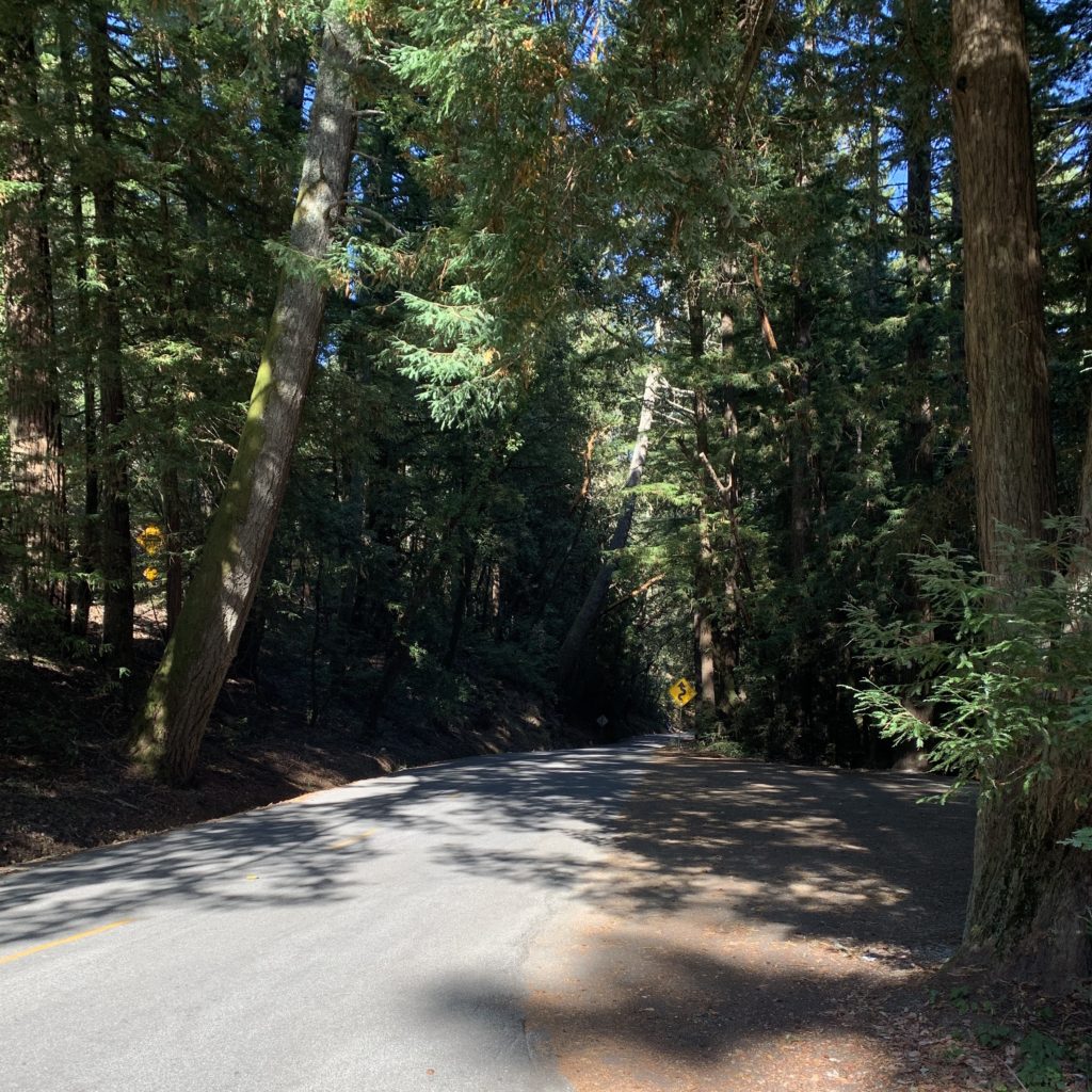
This is a beautiful classic benchmark climb of the region. It is neither terribly steep nor long, but its proximity to population centers and the beauty of its narrow switchbacks and generous shade make it extremely popular. Almost all local riders know their best times up this hill, from the bridge to the stop sign. Each Wednesday it is climbed by the infamous “Noon Ride”, often including national-caliber riders. Its narrow, blind corners make Old La Honda a terrible descent, and almost all rider opt instead to descend nearby Highway 84.
- Distance 4.3 mi
- Climbing 2200 ft
- Grade 7%
Strava
Kings Mountain Road is longer than Old la Honda, with generally shallower grade. You will pass the upper entrance to Huddart park partway up kings. This goes up to skyline opposite Tunitas Creek Road. Return by 84 and Sand Hill Rd. Be wary at the bottom of 84 making the hairpin turn.
- Distance 8.4 mi
- Climbing 2000 ft
- Grade 7% (during climbs)
Strava
The quoted stats for the climb don’t do it proper justice. The measured 8.4 miles start at the intersection with Arastradero and terminate at the intersection with Skyline. The proper climb starts at about 1.2 mile mark where the roads sustains 7-8% grades for around 0.5 miles. Beyond that the grade is highly inconsistent with the steepest pitches in excess of 15%, two intermediates descents, and a sequence of rolling hills. Along the way are some excellent views of the Silicon Valley and of Alpine Creek Basin. As a descent, Page Mill is quite challenging and very popular, especially among experienced descenders. The road is narrow and steep with poor visibility in the corners, however, so riders must watch carefully for motor traffic. Several sections have poor pavement, and the descenders better keep their posteriors out of the saddle. Other routes which cut into Page Mill are Altamont Road and Moody Road, both from Los Altos Hills. Moody is especially notable, as it averages 11.2% over 0.5 twisting miles.
West Alpine comes up the west side of the ridge from Pescadero road, making a shorter loop than Tunitas Creek or full Pescadero. The lower part is shaded, and after emerging from the woods it’s pretty exposed up to the top. The switchbacks on the flat part can be pretty fast before reaching the intersection of Skyline and Page Mill. Some of the turns coming down Page Mill are pitched the wrong direction, so be judicious. There is a water spigot on Page Mill near the top, look for a gate that would be on your right as you are descending after passing the Monte Bello parking areas and going up the little hill.
Mt. Umunhum, named after the local First People’s name for hummingbird, is recently reopened to the summit after many years of the summit being Superfund site due to contamination from the radar station atop the concrete cube that remains. The USAF (and NEXRAD) put their radars up there because it provides an unobstructed view of the Pacific (perfect for detecting Warsaw Pact bombers or incoming cloud formations) and a commanding view over San Jose/Cupertino. On a clear day you can see clear to Mt. Tam and Mt. Diablo. There is no water at the summit, so be prepared. The ascent has some 10-15% sections so be warned.
Short and Steep
- Distance 0.6 mi
- Climbing 385 ft
- Grade 11%
Strava
A longer alternative to Moody and Joaquin to spice up the Portola loop. 5 to 6 minutes when pushing hard. Will take you to the heart of the Westridge hills, a quiet, beautiful, gold-tinged hideaway between Portola and Alpine road.
- Distance 0.2 mi
- Climbing 106 ft
- Grade 16.4%
One block long really steep pitch that is straight and to the point – gain 130 ft or else.
- Distance 0.9 mi
- Climbing 385 ft
- Grade 8%
One of the more pleasant interval climbs. It’s like riding a trail, but paved!
- Distance 0.9 mi
- Climbing 385 ft
- Grade 8%
Summit Springs starts on Tripp and ends 500 ft and a dead pair of legs later. For Patrol, take left at the Kings Mountain Road fork. If you take a right at the dead-end, you get the Patrol interval. If you take a left, you get the steepest part of the Summit Springs.
- Distance 0.4 mi
- Climbing 300 ft
- Grade 11%
Strava
Some people do intervals on this 0.5 miles 320 climb while others grimace at the thought of surviving it once. If you had the capacity to stop pondering the meaning of pain, you’d realize that the climb is quite pretty. Buena Vista Dr to the left of the stop sign is a good place to rest your aching bones.
- Distance 0.3 mi
- Climbing 253 ft
- Grade 14%
Strava
At the end of Alpine road, deep in the Los Trancos Woods, just about where it meets the gated end, it is brutally steep (max 19%) but not too long. Did I say not long? Scratch that, it is long enough at that! At the end Joaquin connects to Old Spanish Trail which oers alternative ways to descend to Los Trancos. Old Spanish Trail itself is a very old road that existed way before Joaquin, Page Mill or Alpine. Public section dead ends at the private property but the road continues to its eventual junction with Page Mill even if unpaved.
East Bay
- Distance 12.3 mi
- Climbing 3670 ft
- Grade 5.7%
Strava
Escape to the curves or simply ride up for the intense view. North Gate Road to the summit is only a mere 11 miles. It seems much longer. It starts in Walnut Creek at the intersection with Oak Grove Ave. The ride is very curvy but not too steep. Headed up the hill is an amazing experience. The unobstructed views are to die for as North Gate Road climbs up the west side of the mountain, and every single corner will have you pulling to the side to stare in amazement. This level of openness is probably unparalleled in the entire Bay Area. The lower elevation flows up a draw and then it’s a series of switchbacks weaving a tapestry of pavement up the mountainside. Pavement quality is average, not spectacular, not horrible. There will be some crumbly sections along the edges and much of the ride has no center line. And the climb is steady and not excessively steep. As a descent North Gate Rd is very nice.
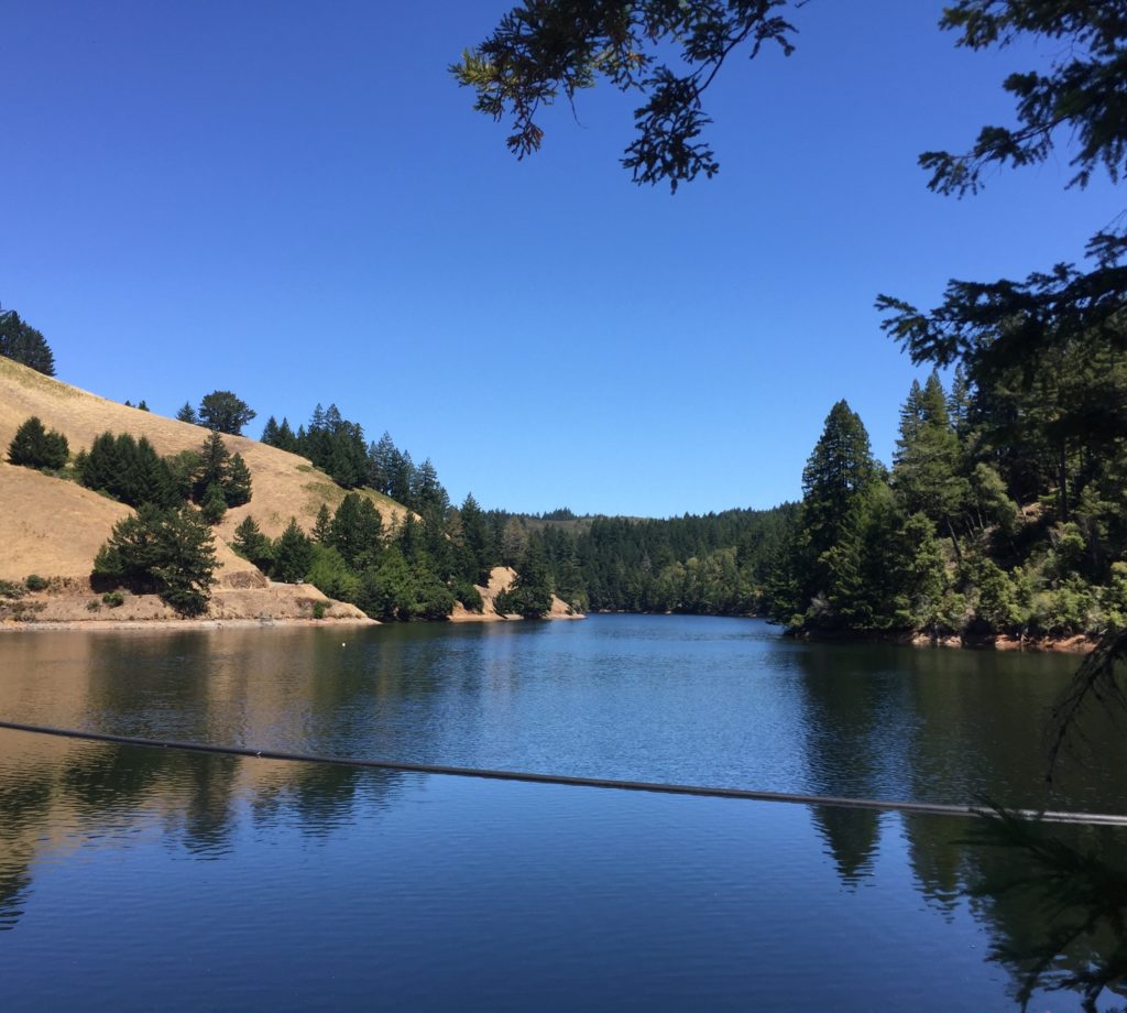
Calaveras rivals the Pacific Coast rides in beauty, with vibrant colors from vegetation and the water of the reservoir, particularly in the Spring. Reaching it and returning require some “junk” miles over the Dumbarton Bridge or along the Bay and Highway 237, but it’s entirely worth it. Calaveras can be ridden in either direction, but we prefer south-to-north since it avoids having to climb a busy Highway 84 with partial shoulder. Taken this direction, Calaveras gains elevation at probably 5%, but levels off and becomes a series of sharp switchbacks rising and descending – a great place to practice cornering with a view of the Calaveras Reservoir and Sunol backcountry. Calaveras Dam, which creates the reservoir, used to be the largest earth fill dam in the world. After being rebuilt once due to liquefaction, it is currently under construction again to strengthen it during an earthquake (see note above). A long straightaway leads to the town of Sunol with its classic train station and railway. Follow the railway and river through the Sunol Valley until you reach the Town of Niles, which contains one of our favorite coffee stops, the excellent, bike-friendly Devout Coffee. From here you can ride the surface streets or take the Alameda Creek trail bike path back to the Dumbarton.
Palomares plays out similarly to Calaveras, sans reservoir. Palomares is an isolated canyon road with almost no traffic (particularly since the extended road closure in 2017). It forks off Niles Canyon Rd east of Fremont and leads to Palo Verde road and Eden Canyon Rd that parallels I-580 between Castro Valley and Dublin. There is a particularly steep climb in the North-to-South direction, which in our opinion is more fun as a fast, straight descent. Couple of wineries along the way, and cool streamside shade.
- Distance 5.4 mi
- Climbing 1430 ft
- Grade 5.0%
Strava (south-to-north)
Morgan territory is a great addition to a Mt. Diablo ride. It’s an Old La Honda-class climb. Going north-to-south the views are great, but the descent is twisty along a very poorly paved road. Most locals tackle this route heading north-to-south.
- Distance 5.1 mi
- Climbing 2100 ft
- Grade 7.7%
Strava
Quimby Rd is a short cut which bypasses the section of Mount Hamilton Road to the first intermediate descent, eliminating 8 miles and 1500 feet of climbing. It starts o innocently in a residential neighborhood deep in San Jose, but the grade increases steadily, until with 1 mile to go one is assaulted with a series of vertical switchbacks and an extremely steep, truly daunting final straight which, with the help of the pitiless sun, will sap any remaining strength from the legs. Final 3.1 miles gain 1650 , more than 10%, while the last 1.2 miles average even more – 11.5%. Two farm gates on the top. Following the climb is a 1-mile descent to Mount Hamilton Road, losing 600 feet. After surviving this, climbing the remaining 2800 feet of Mount Hamilton Road seems trivial. Wild turkeys may observe suffering from sidelines, so try to put on a good show.
Kincaid Rd is a dead end sinuously winding off-shoot connecting Mt. Hamilton Rd and Olondo Creek. Aer couple of rolling miles on good pavement it heads down densely forested canyon at almost 11%, crosses the bridge, and then climbs on the other side for another 2 miles at 7.1% grade, and then briefly descends to a dead end at the gate. Traffic is almost non-existent, pastoral views abound and the surface is a bit abrasive, especially after the bridge. As pavement continues beyond the gate It is tempting to know what’s hidden there … Roundtrip is 12 miles and is a nice add-on to Mt. Hamilton expeditions.
- Distance 4.1 mi
- Climbing 1910 ft
- Grade 8.8%
Strava segment
Welch Creek Road is not known to many cyclists, particularly on the Peninsula. The reason is twofold. First, the climb is away from civilization, in the Sunol Regional Wilderness in the East Bay. It’s off of Calaveras a few miles past the 680 underpass, right before Calaveras itself starts climbing, at the place known as Haynes Gulch, flanked to the le by Apperson Ridge with its mighty Maguire Peaks (trail to the top is at 0.72 mi mark, but no bikes are allowed on that trail). Second, many bruised souls conceal their traumatic experiences with this long climb. It’s a monster that will grind you to the bone, will turn your quads to jelly, will bake you in the cruel sun or envelope in wintry fog. The difficulty of its narrow one lane with abrasive pavement, and inconsistent gradient is tempered by the views and sounds of the creek (in the winter), and open skies and pastures at the top but accentuated by frequent (four or five total) cattleguards. Sunol Regional Park stretches from 0.3 to 2.8 mile markers. Within the park, a stretch of road between 2.0 and 2.5 mile markers is bloody steep, in excess of 15%. Above 2.8 mark, the road emerges from the canyon and becomes steeper again, bloody steeper. By the finish the gradient is truly bloody relentless. Views towards the bay could be tremendous. See also here. Net climbing is only about 1900 but will all the ups and downs you’ll end up climbing 2265 , which would produce 10.7% average grade. Vultures are ready to pick on your exhausted meat, I mean muscles. You can also see acorn woodpecker, black phoebe, titmouse, yellow-billed magpie and turkey vulture. Did I mention it is long (and that’s only to the end of paved section, dirt segment continues far beyond, as a bike legal dirt fire road for another 3.4 miles towards Rose Peak (which itself is only 36 lower than Mt. Diablo) but much less steeply, and “No Motor Vehicles” signs could obviously be ignored) and illegal beyond the border of Ohlone Wilderness? Since there are multiple cattleguards on steep stretches, caution and good brake pads are advised when descending. For the daring … Update: Sometime in 2007 the road was repaved and asphalt is pristine – Enjoy!
- Distance 3.4 mi
- Climbing 1170 ft
- Grade 6.4%
Weller Rd is an interesting side road to Calaveras which takes one up behind the east side of Mt. Allison, the highest of the three peaks (Mission, Allison, and Monument) immediately east of Milpitas. Not too steep, but not too shady either. The road traverses mostly farm land which in ancient times belonged to Tamyen Ohlone tribe. The name is that of one of the pioneers buried at the Laguna cemetery in Ed R. Levin Regional Park (below Weller Rd on Calaveras Rd). Beyond the gate the road continues for a few more miles as paved private road, and eventually turns to dirt. As you ride up the hill you may notice stone walls around the ridges. Some of these were built by an Amish family that lived here, others are very ancient and their origin is hidden in the dark ages.
- Distance 5.7 mi
- Climbing 1910 ft
- Grade 6.6%
Sierra Road climbs from busy Piedmont Road into the residentially-populated hills over Milpitas. The grade is steady near 10%. This selective hill was used in the Tour of California and inflicted pain even on jaded professional cyclists. The views are fabulous, whether looking towards the Bay or towards Black Mountain, Mt. Day, Rattlesnake Butte, or Mt. Hamilton. At the top, Sierra Rd continues as a rolling, twisting, narrow road to Felter Road, rewarding riders with some excellent views (which accounts for much lower overall grade). Unlike climbs on the coastal range, Sierra Road has significant sun exposure, and thus can be extra challenging during hot summer days.
- Distance 18.3 mi
- Climbing 4380 ft
- Grade 6-7% (during climbs)
Strava
Phil Gaimon rides Mt Hamilton
Mount Hamilton Road climbs from San Jose on Alum Rock Avenue to Lick Observatory at the Mount Hamilton summit. It is actually three climbs, with three climbing sections separated by moderate descents of 2 miles and 1 mile. As is clear from the distance, the grade is shallow, but the climb seems to go on forever. When one gets sight of the summit, and the end seems near, there is still five miles of climbing to go. Each year there is a famous USCF race over the top, down twisting San Antonio Valley Road, and on to Livermore. There is also the popular “Mount Hamilton Challenge” recreational ride every year, which also passes over the summit. Mt Hamilton Road oers some wide views of the San Jose area below, which is impressive if one likes unfettered urban sprawl. All the climbing pays off, however, when from the summit, on a clear day, one can see all the way to the Sierra. You can also see the sinuous path the road took you to the summit. The descent of Mount Hamilton Road is neither especially bad nor good. The shallow grade limits speeds, and one must keep a constant watch for auto traffic, but it isn’t nearly as challenging as the descent of San Antonio Mountain Road to the east. The lower portion of Mt Hamilton is riddled with slick patchwork on the pavement, and thus care must be exercised here, especially in wet conditions.
- Distance 10.8 mi
- Climbing 3500 ft
- Grade 6.2%
Strava
Mt. Diablo towers over the East Bay area with the summit altitude of 3,849 . On a clear day, views from its 3849 foot summit stretch more than 200 miles. Mount Diablo has the largest viewshields in the United States and second in the world (the first one is Mt. Kilimanjaro). Mount Diablo is eclipsed only by Mount Hamilton in total height, but, unlike Mount Hamilton, there are no downhill sections as you head towards the top. Also, the average grade is steeper than Mount Hamilton, and that killer section at the very end is a religious experience! The South Gate Rd climb officially starts at the altitude 800 in Danville at Athenian School. Very pretty road with little traffic, initially narrow, with some pothole and a few tight turns and small descents. In 2 miles, you reach intersection with North Gate, South Gate Roads and Mount Diablo Scenic Blvd ends at the ranger’s station. The grade increases from there on but the view is spectacular and more than compensates. You can even see Santa Cruz mountains on the other side of the bay. The grade levels o in a few places to provide some relief. The very finish is quite steep – way over 10% and will demand some prayers! As a descent the road has its twists but it is not too bad because it’s not particularly steep. This route is also the site of annual Mt. Diablo Challenge, a ride to benefit American Lung Association, first Sunday of October each year. See if you can beat 1 hour! On the summit is a small museum and a rather impressively built lookout dating back to the 1930’s and the era of the Civilian Conservation Corps. On a clear day one can see Mt. Lassen, Mt. Shasta (with binoculars), and even Yosemite’s Half Dome in Sierras!
Longer Rides
- Distance 87.2 mi
- Climbing 10,450 ft
- Grade ~8-9% (during climb)
Strava
Climb Page Mill and Skyline Roads to Castle Rock, drop down to Highway 17 via the narrow, twisty section of Skyline Road (up the hill from Lexington Reservoir) and then climb along Summit Road towards Loma Prieta. This lung-busting ascent climbs close to 2,000 feet up to near the summit of Loma Prieta, with exposed roads offering high heat in the summer but warmth and epic views during the cooler winter months. Be prepared for a few potholes once the road turns to dirt, but the road is generally kept in good condition. The Summit Store nearby makes a great lunch spot!
- Distance 82 mi
- Climbing 7,350 ft
Strava
Offering beautiful views of the Pacific from a high ridgeline above Pacifica, Planet of the Apes is a one-time road now crumbled largely into dirt in many spots. It is best done north-to-south starting from Pacifica and ending in Montara a ways north of Half Moon Bay. Multiple options exist to ride to Pacific from either the coast via Highway 1 or from inland via the northern extension of Highway 35. Don’t forget to refuel with coffee & pastries once or twice in Half Moon Bay!
- Distance 82 mi
- Climbing 7,500 ft
- Grade ~7% average on Zayante
Strava
Rolling through the Santa Cruz mountains along Skyline and dropping down to the rustic mountain city of Boulder Creek for lunch, this route provides an all-day ride with beautiful scenery and plenty of climbing. The return route features Zayante, an infamous climb through dense forest featuring a number of grueling, steep pitches.
Farther afield
- Distance 63.5 mi
- Climbing 6970 ft
- Grade ~7% (during climb)
Strava
Cross the Golden Gate Bridge, do a short loop in the Marin Headlands and continue on to Mt Tam–one of the iconic bay area climbs.
- Distance 106.4 mi
- Climbing 7,377 ft
Strava
Cross the golden gate bridge ride over to the point reyes lighthouse.
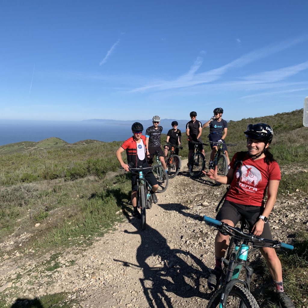
Dirt Routes
Short and flat-ish
Along with Skeggs, Water Dog Park is the closest collection of technical singletrack to Stanford. The park is quite small, but once inside the hills and trees obscure the surrounding houses and cityscape. Additionally, a surprising amount of trails are packed into the small area, with a variety of terrain from fast and flowy to rocky and rooty, with a few built-up features here and there as well.
Arastradero Preserve hosts the closest collection of singletrack to campus. The trails are all beginner-friendly, with a number of small (several-minute) climbs available leading to foothills views of the dish, Palo Alto, and the Bay to the north, and of the Santa Cruz mountains to the south. The hills are bright green in the winter, turning to brown in in late spring, with a few areas of California chaparral-style forest.
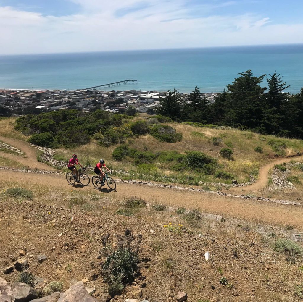
Moderate Length
- Distance From Campus 30 minutes
- Typical Ride Length 10-18mi
- Climbing 200+ ft / mile
Strava 1
Strava 2
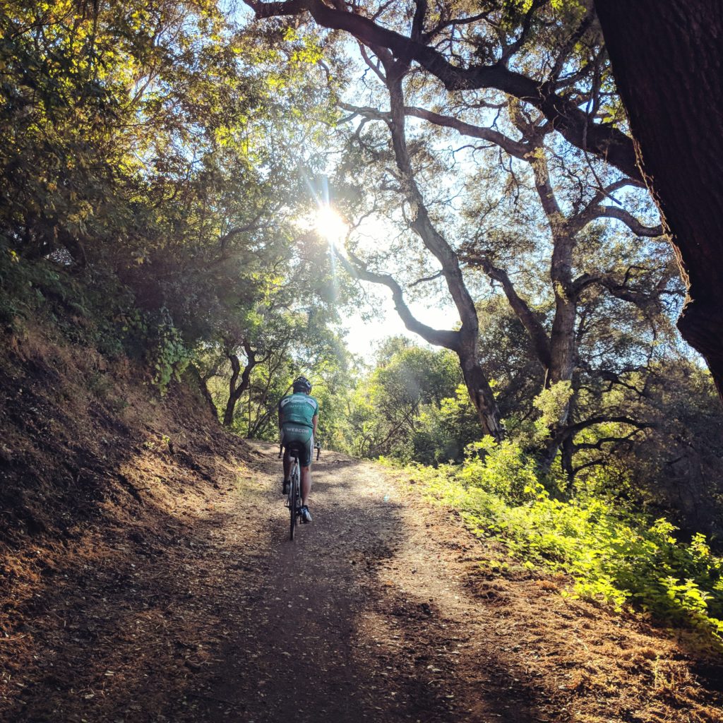
Commonly referred to as Skeggs due to the location of the original parking lot at Skeggs Point, El Corte de Madera Open Space Preserve hosts the finest collection of bike-legal trails in the Bay Area (outside of Santa Cruz). Built off of old logging roads deep in redwood forests, the park boasts close to 30 miles of trails, with a variety of difficulty levels ranging from the beginner-friendly Sierra Morena trail along Skyline to the remote, technical South Leaf trail at the bottom of the park. Regardless of the route you take, though, expect lots of lung-busting climbing as you pay for your fun by ascending back to your car.
Soquel Demonstration Forest has one of the the best collections of downhill trails accessible from the Bay. Accessed off of Highland Way an hour’s drive from campus, a dirt-road climb takes you up to the top of the park, where a spine of singletrack offers access to a collection of downhill trails ranging from the beginner-friendly Flow Trail to the rough & rowdy Braille Trail. Either way you go, be prepared for a long climb back out to your car.
- Distance 30mi
- Climbing 3,000 ft
Strava
For a standard 3-hour loop starting from campus, take a ride to Russian Ridge for some epic views and flowy singletrack. Climb up to the ridge via either Windy Hill or Dirt Alpine, wander around the park(s) for a while (Ridge Trail, Hawk Trail and Ancient Oaks Trail are the highlights) and then drop down via either Cloud’s Rest or Crazy Pete’s to Dirt Alpine for a blazing-fast descent home. Stop by Robert’s Market on the way back for some snacks to finish off the ride.
Ludicrous
- Distance 56 miles
- Climbing 6,300 ft
Strava
If you’d like to do the ultra-long ridge ride with almost half the effort, this option takes you along the full length of the ridge trail, drops down to Lake Ranch, then keeps going, dropping down into Los Gatos and then continuing along a pedestrian/bike path into Campbell then San Jose to the light rail train station. Dinner options exist in Los Gatos, Campbell, and San Jose before catching the train back home.
- Distance 66 miles
- Climbing 9,000 ft
Strava
4-hour long rides just not long enough for you? Have a whole day to spare and want to burn a couple day’s worth of calories? Want to see nothing but trees and mountain views all day? Then this is the ride for you! The ride starts with about 2,000 feet of climbing to get up to the ridge trail network starting with Russian Ridge, Skyline Ridge, and Long Ridge open space preserves, but there’s almost never a flat moment of riding for the remainder of the day. The rolling hills along the ridgeline offer a variety of terrain from ocean views in open grassland to redwood forests, with trails ranging from doubletrack to technical, rocky singletrack (though not much of the latter). The out-and-back turnaround point is at Lake Ranch at the bottom of John Nicholas Trail, a practically purpose-built flow trail dropping 1,000 feet from the ridge down to the lake. Along the way, a water refill option exists at the fire station near Highway 9, and during the summer, you can often get yourself a hot dog and a soda at Mr. Mustard’s hot dog stand at the Saratoga Gap parking lot (intersection of Skyline and Highway 9). If the whole route is a little too much sufferfest for you, you can turn around at any point along the route, and even bail to Skyline Road for easier going than the trail.
Further Afield
- Climb Length: 5 miles
- Climb Height: 2,100 ft
- Climb Grade: 12+%
Strava
If riding demoralizingly steep dirt roads up to amazing viewpoints is your thing, then start from Los Gatos, warm up with a climb up to Lexington Reservoir, then take Limekiln Trail through Sierra Azul Open Space Preserve an additional 2,100 feet up to the peak of El Sombroso. With the peak standing alone at 3,000 feet, on a clear day you can see much of the Bay to one side, valleys all around, and just to the south on a nearby ridge the big block on Mt Umunhum is clearly visible. Though closed for many years, Barlow Road and Mt Umunhum Trail are open as of September 2017 to provide access to the renovated peak via dirt trails. Finish off the ride with a stroll through Almaden Quicksilver park for some bonus singletrack after the brake-burning descent down the opposite side of El Sombroso.